
Flood Markers – Where to Find Them
In our previous blog, we explored what flood markers are and why they matter. Now it's time to seek out some of the Thames Path's most fascinating examples. Scattered along the river are dozens of reminders of historic floods. Some are easy to miss, while others stand proudly on lock buildings and riverside structures. Together they tell the story of a river that has shaped the landscape for centuries.
Here are a few places where Thames Path walkers can start their flood marker treasure hunt.
Pinkhill Lock – A Tale of Two Floods
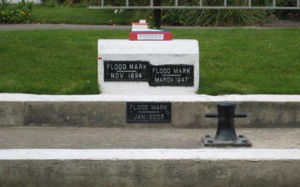
One of the most interesting examples can be found at Pinkhill Lock, near Farmoor and the Pinkhill Nature Reserve. Here you'll find flood markers recording the November 1894 flood and the January 2005 flood, displayed side-by-side. The markers offer a rare opportunity to compare two major flood events more than a century apart. Surrounded by wetlands and wildlife, Pinkhill feels wonderfully peaceful today. Yet these markers reveal that the surrounding landscape has occasionally been transformed into a vast sheet of floodwater. It's a fantastic place to pause and imagine how different the scene would have looked during those record floods.
Photo: Pinkhill Lock Flood Markers
Sandford Lock – Evidence of the River's Power
Further downstream, Sandford Lock provides another excellent opportunity to spot flood markers. This is a powerful stretch of river and has long been associated with fast flows and dramatic river conditions. The flood markers here help tell the story of periods when the Thames rose far beyond its normal boundaries. Standing beside the lock on a sunny day, it's difficult to imagine the river occupying so much additional space. That's exactly what makes these markers so fascinating.
Iffley Lock and Oxford's Flood History
Oxford has experienced flooding throughout its history, making the area around Iffley Lock particularly interesting for anyone curious about the river's past. The city contains numerous flood markers on buildings, bridges and riverside structures. Together they create a timeline of significant flood events and highlight the importance of Oxford's extensive floodplains. For walkers enjoying this beautiful section of the Thames Path, they're a reminder that the river has always played a powerful role in shaping the city.
Marsh Lock Near Henley
Near Henley-on-Thames, observant walkers may spot flood markers around Marsh Lock.
This picturesque part of the river attracts visitors for its boating heritage and attractive scenery, but flood markers reveal another side to its story. They offer glimpses into past flood events and the challenges faced by riverside communities.
Historic Riverside Towns
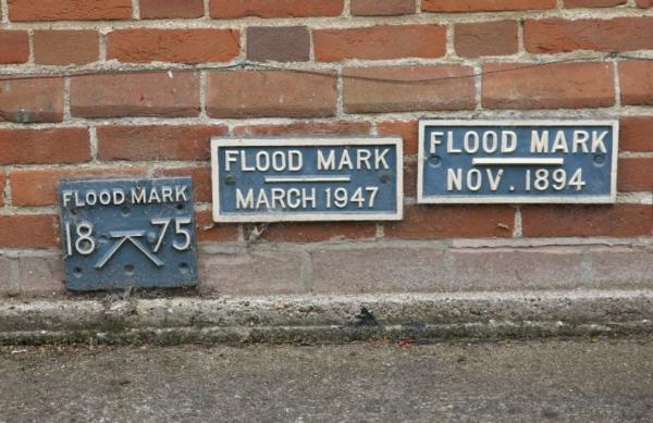
Flood markers aren't limited to lock sites. As you pass through historic Thames towns such as Abingdon, Wallingford and Reading, keep an eye on older buildings and riverside walls. Many contain plaques or marks recording notable floods from years gone by. Unlike museum exhibits, these remain exactly where the events occurred, allowing you to stand in the very spot where floodwaters once rose.
Photo: Flood Markers in Abingdon
Looking Beyond the Marker
What makes these signs so compelling is not simply the height they record. Each marker represents a moment when the Thames reminded people of its immense power. Behind every plaque lies a story of flooded meadows, disrupted travel, resilient communities and landscapes shaped by water. Together they form a remarkable outdoor archive stretching along much of the Thames Path.
So next time you're walking beside the river, slow down and look carefully at the details around you. A small metal plaque could reveal one of the most dramatic chapters in the Thames' long history.
Have you discovered a flood marker along the Thames Path? Take a photograph, compare it with others you've found, and imagine what the river looked like on the day that mark was made.