Historic Boundary Stones – Markers of a Forgotten Landscape
Hidden among hedgerows, tucked beside pathways and standing quietly in fields, boundary stones are some of the Thames Path's most fascinating historical treasures.
Long before modern maps and satellite navigation, these stones marked parish boundaries, county borders, estate limits and areas of land ownership. Many have stood exactly where they are for hundreds of years.
Excellent examples can be found near Oxford, Goring, Runnymede and parts of the upper Thames, where ancient parish boundaries often followed natural features such as streams, woodlands and the river itself.
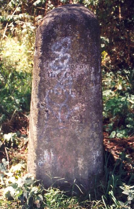
Some stones are inscribed with initials, dates or symbols representing the authorities responsible for maintaining the boundary. Others appear deceptively plain but remain significant pieces of local history. The one in the image below is near Oxford, on the path between Folly Bridge and Iffley and says:
"Here end the Liberties of the City of Oxford".
A liberty in this context means “the district outside a city over which its jurisdiction extends”, and the word is also used in the plural in the same sense.
For walkers interested in heritage, these markers provide a tangible connection to the communities that have lived and worked beside the Thames across the centuries. They remind us that every landscape has a story, even if it isn't immediately obvious.
Look out for: Carved initials, parish markers and weathered stone posts partially hidden by vegetation.